Monitoring and Assessing Risks to the Environment
Identifying impacts through environmental monitoring.
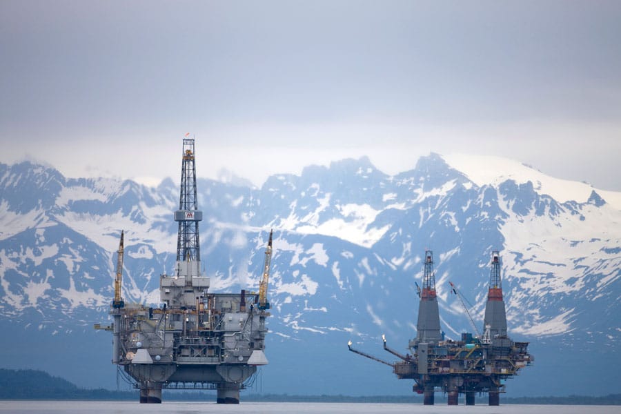
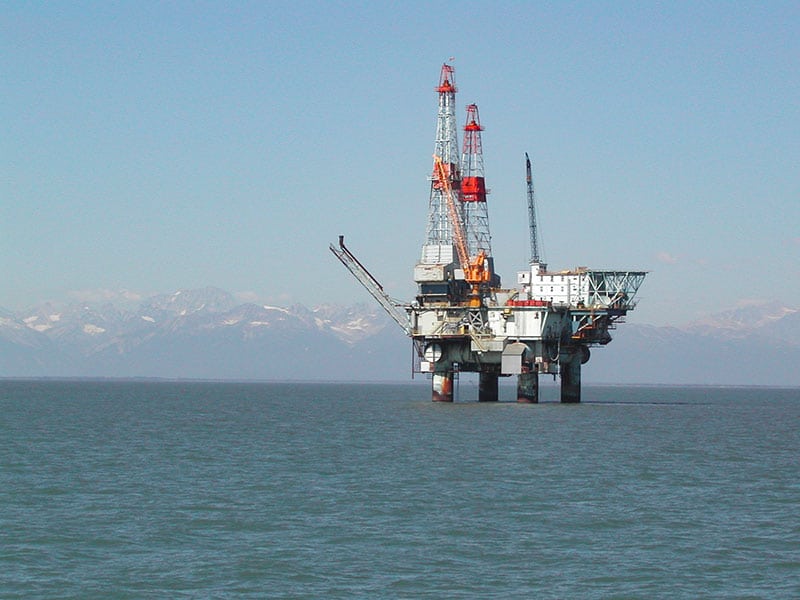
CIRCAC has been a leader in providing environmental monitoring data over the past 25 years and has compiled a substantial record of hydrocarbon and other contaminants in sediments, water, and animal tissues throughout Cook Inlet. CIRCAC’s Environmental Monitoring Committee (EMC) recognized that oil spills pose significant environmental risks, as proved by the Exxon Valdez oil spill along the Gulf of Alaska coast. Components of the monitoring program included collecting data and information essential for assessing impacts of any future spills. EMC decided early on, that one of their main concerns was potential impacts from discharges–mainly produced water– but also drill muds and cuttings. These discharge streams contain contaminants and are permitted as part of normal day-to-day operations and thus have the potential to accumulate in the environment over time.
Produced water is water that comes to the surface with oil and gas and contains many chemical constituents, including hydrocarbons. Drill muds and cuttings can also include hydrocarbons, but are of concern especially for the heavy metal contaminants. Assessing these potential impacts and developing an understanding of Cook Inlet natural background concentrations of many of the contaminants have been the focus of CIRCAC’s Environmental Monitoring Committee over the past 25 years. EMC’s monitoring strategy has also included “fingerprinting” analyses of hydrocarbons to determine likely sources of those molecules.
Highlights of the 25 years of EMC’s research, monitoring, and assessment work in Cook Inlet are described below. More information and study results can be gathered by looking at specific program details elsewhere on CIRCAC’s website.
TIMELINE OF MAJOR INITIATIVES & ACCOMPLISHMENTS
1990
Congress creates Cook Inlet Regional Citizens Advisory Council (CIRCAC). First formative meeting is held October 26.
1991
Initiates Safety of Navigation and Oil Spill Contingency Plan project.
1992
Certified by US Coast Guard; initiates comprehensive review of Safety of Navigation and Oil Spill Contingency Plans; completes inventory of oil operations within Cook Inlet drainage; convenes safety of navigation workgroup.
1993
Completes Cook Inlet Platform Structural Integrity Study; launches environmental monitoring pilot program.
1994
Completes human factors needs assessment; enters into Geographic Information System mapping project with NOAA.
1995
Participates in Safety and Efficiency of Navigation in Cook Inlet forum.
1996
Completes long term intertidal baseline study; completes Contingency Plan in Cook Inlet Process and Efficiency study.
1997
Completes broken ice study; begins Cook Inlet intertidal surveys.
1998
Co-sponsors ice symposium; launches initiative to develop Geographic Response Strategies for Cook Inlet areas and harbors.
1999
Sponsors Safety of Navigation in Cook Inlet Forum.
2000
Receives States/BC Task Force Legacy Award for extraordinary efforts to prevent oil spills; completes pipeline safety study.
2001
Conducts a demonstration project applying a coastal habitat inventory method called ShoreZone that uses aerial surveys to photograph and map the nearshore habitats.
2002
Develops Alaska’s first surveys for National Coastal Assessment through Environmental Monitoring and Assessment Program; hosts Cook Inlet Subsea Pipeline Forum to discuss condition of pipelines; secures agreement with operators for voluntary pipeline status reports; initiates development of marine firefighting manual for Cook Inlet; assists in developing non-tank vessel regulations.
2003
Completes GRSs for 125 locations with plans for sites in Northern and Southwestern Cook Inlet; sponsors ballast water discharge report.
2004
Commissions white paper on dismantlement, removal and restoration of unused platforms; launches study of dissolved and particulate metals in Cook Inlet watershed.
2005
Designs Geographic Resource Information Network (GRIN) to address logistical needs; initiates Alaska Oil Spill Permit Forms and Applications Project to minimize paperwork and speed response; commissions pipeline integrity report for subsea pipelines; completes 127 Geographic Response strategies (GRSs); completes Marine Firefighting Manual and Salvage Plan for inclusion in Cook Inlet Subarea Plans; completes hydrographic surveys at major transects.
2006
Completes GRIN Prototype and vessel traffic study; partners to identify Kodiak Places of Refuge, develops 43 GRSs for Kodiak, Afognak and Alaska Peninsula across Shelikof Strait; receives funding for ballast water sampling; initiates salt marsh mapping project for Upper Cook Inlet.
2007
Passes resolution to urge USCG to permanently station docking assist tug in Nikiski funded by shippers and producers; succeeds in convincing Tesoro Alaska to station M/V Protector; Tesoro contracts for construction of new tractor tug; CIRCAC assembles Cook Inlet’s first network of ice observers located throughout the Inlet; partners to evaluate risks of non-indigenous species via ballast tank discharges from ships; sharply criticizes EPA for inadequately addressing public comments in NPDES Permit for discharges from platforms and facilities; ShoreZone becomes statewide program; initiates Clean Harbors and Marinas Initiative with the Alaska Department of Environmental Conservation; honored by the Alaska State Legislature for outstanding environmental accomplishments and contingency plan reviews; hosts two-day Navigational Safety Forum; conceives idea for ice forecasting network of cameras.
2008
Develops Integrated Cook Inlet Contaminants Program; negotiates an agreement with Cook Inlet’s pipeline operators for volunteer pipeline reports to ensure pipelines’ structural integrity.
2009
Completes groundwork for Ice Forecasting Camera Network; conducts intertidal sampling program.
2010
Celebrates 20 years as an organization; secures funding for a Cook Inlet Navigational Risk Assessment, receives USCG Meritorious Public Service Award for leadership during Mount Redoubt’s threat to the Drift River Terminal in March 2009, the Seabulk Pride grounding in February 2006 and the sinking of the Monarch in January 2009; completes biophysical habitat mapping and imagery for every inch of shorelines within our areas of concern.
2011
Creates Coastal Impressions Exhibit; as member of Cook Inlet Risk Assessment Management Team, completes Vessel Traffic Study and develops framework for Spill and Accident Causality Study.
2012
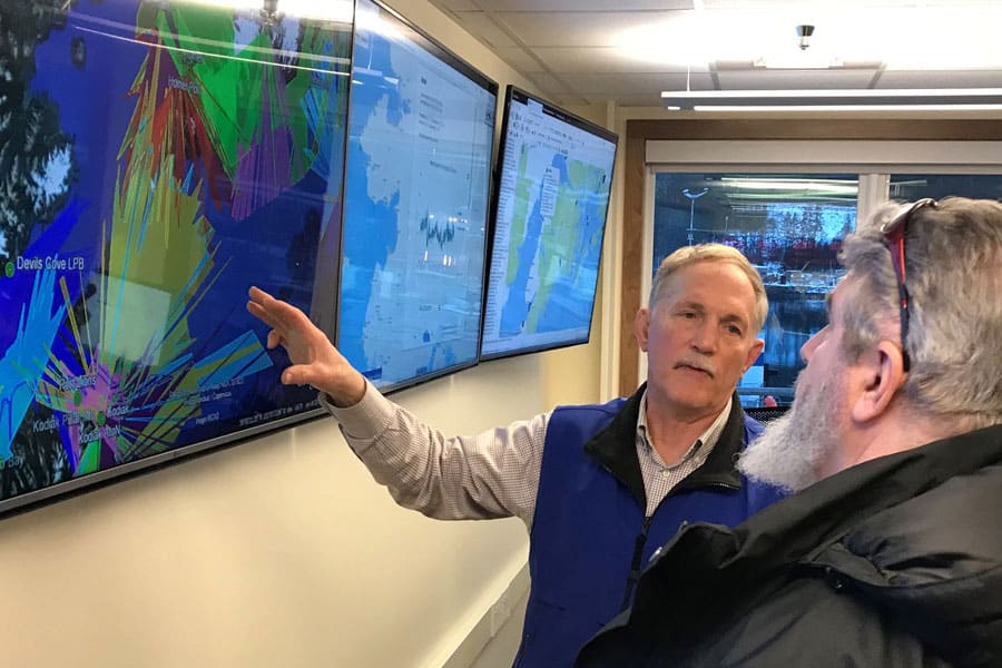
Leads a Cook Inlet Risk Assessment Consequence Analysis Workshop. Issues position paper supporting subsea pipeline and dismantlement of the Drift River Oil Terminal to reduce tanker traffic. Partners with Alaska Ocean Observing System (AOOS) to develop the Cook Inlet Response Tool.
2013
World class Bob Franco docking assist/rescue tug goes to work in Cook Inlet. Completes Beluga Whale Winter Prey and Habitat Study.
2014
Completes Cook Inlet Navigation Risk Assessment. Ice Forecasting Camera Network consists of 9 cameras.
2015
Celebrates 25 years as an organization; the Cook Inlet Harbor Safety Committee is created and holds its first meetings; CIRCAC is honored by the Alaska State Legislature for 25 years of accomplishments; CIRCAC develops scholarship program and awards first two for environmental or maritime studies; Alaska ShoreZone is statewide program that has mapped 80% of Alaska’s coastline; GRS is now a statewide program and included in sub-area plans for the entire state, with the exception of the Arctic.
See our 25-Year Anniversary Report.
2016
Director of Science and Research receives Ocean Leadership Award.
2017
Completes vessel self-arrest study which results in industry commitment to advanced simulator training for Cook Inlet mariners and crew. Launches Cook Inlet Pipeline Infrastructure Assessment.
2018
Awarded the U.S. Coast Guard’s Meritorious Public Service Award for leadership, advocacy, and partnership instrumental in establishing the Cook Inlet Harbor Safety Committee. Cuts the ribbon celebrating the completion of Harvest Alaska’s Cross-Inlet Subsea Pipeline, effectively fulfilling a goal we set in 2012 to improve navigation safety by reducing tanker traffic and shutting down the Drift River Oil Terminal.
2019
Partners with Marathon Petroleum to create a new scholarship, administered by AVTEC, for students entering Alaska’s Maritime Training Center. Supports marine snow research. Upgrades and expands Ice Camera Network. CIRCAC has received USCG recertification every year without exception; CIRCAC continues to fulfill its responsibilities to conduct contingency plan and technical reviews, serves as a member of Dispersants Working Group, Cook Inlet Sub-Area Planning Workgroup, Interstate Oil and Gas Compact Commission (IOGCC), Kenai Peninsula Local Emergency Planning Committee (LEPC), International Oil Spill Conference (IOSC) and Alaska Regional Response Team, among others, and participates in the Incident Command Center during incidents, drills and exercises.
INITIAL YEARS
Within a year of its formation, CIRCAC’s Environmental Monitoring Committee (EMC) held a series of meetings and workshops with experts to identify what is meant by the OPA 90 mandate to conduct a “comprehensive environmental monitoring” program. We discussed Baseline, Compliance, Event, Resource Management, and Scientific monitoring to isolate which addressed the various known Cook Inlet environmental threats and to begin developing an attainable program under the fiscal limitations of CIRCAC’s budget. With the help of these experts and a contractor, in 1992, CIRCAC released a conceptual monitoring program in the report titled A Comprehensive Monitoring Program for Cook Inlet, Alaska.
First Field Study 1993
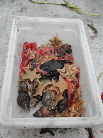
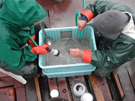
EMC’s initial pilot study was conducted as a basis for early-warning detection of environmental impacts of oil industry operations. It combined two monitoring strategies: the well-known, established Sediment Quality Triad (SQT) and a newer program called “mussel watch.” The SQT component measured sediment hydrocarbon contamination, sediment toxicity, and signs of pollutant-related ecological stress in areas within oil industry operations, upstream and far downstream of discharges. Caged mussels (Mytilus edulis) were also deployed in the water column to filter-feed in areas of produced water discharges (and in control areas).
Continued Field Studies (1994-1997)
A series of studies from 1994 through 1997 continued to use SQT or modified-SQT methods, as well as tissue analyses of mussels or other resident organisms. These studies sampled within permitted discharge mixing zones, in industry concentration areas, and in areas up-current and down-current from the discharges. Over time, EMC accumulated hundreds of data points with detailed information about hydrocarbon and metal contaminants in sediments and in certain benthic organisms, along with many other measurements of the physical and oceanographic environment. Other studies focused on the northern Shelikof Strait, the Kenai River Estuary, and the Lake Clark National Park shoreline.
TECHNICAL PROGRAM EVALUATION
After 5-years of focusing the environmental monitoring program on assessing potential impacts from day-to-day oil industry operations (e.g. produced water discharges), EMC decided to reevaluate the program through an independent team. The review found that the studies were not showing accumulation of hydrocarbons or metals in Cook Inlet sediments or benthic invertebrates. It recommended that CIRCAC periodically monitor for impacts from discharges, while shifting the focus to intertidal habitats to identify areas and intertidal species or community assemblages that might be most at risk from an oil spill, and that could be used as “sentinel species.”
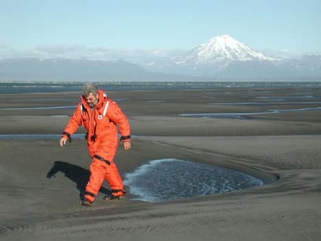
INTERTIDAL RECONNAISSANCE
A reconnaissance survey was conducted in 2000 in central and upper Cook Inlet to identify populations of clams and other sediment-dwelling organisms to determine their value as potential sentinel species (species that are relatively long-lived that could integrate contaminants from a spilled oil slick reaching shore). The study found that two main factors influence distribution and abundance of these sediment-dwelling invertebrates in the study area–extreme tidal currents and the massive loads of silt from the northern river systems. Hydrocarbon analyses were done on sediments and invertebrate tissues at 25 potential sentinel stations to provide baseline information. In 2002, additional sites were sampled in Kamishak Bay, to include lower Cook Inlet in the study area.
SOUTHCENTRAL & SOUTHEAST ENVIRONMENTAL MONITORING & ASSESSMENT PROGRAM
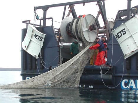
Prior to 2002, all of CIRCAC’s contaminant monitoring samples had been collected from within Cook Inlet or the very northern part of Shelikof Strait. There was a lack of information from areas that had no potential for impact from Cook Inlet oil industry operations and much of the work done by others outside of Cook Inlet focused on areas where there were concerns of anthropogenic contamination from other sources (e.g. areas exposed to Exxon Valdez spilled oil). Thus, it was difficult to describe CIRCAC’s data in the context of a larger background body of information. In 2002, CIRCAC partnered with the ADEC to conduct Alaska’s first component of the EPA-funded National Coastal Assessment. CIRCAC provided the scientific lead for this Southcentral Alaska Environmental Monitoring and Assessment Program (EMAP). Fifty stations were randomly selected from all coastal bays and estuaries in the western Gulf of Alaska, ranging from Unimak Pass to the Copper River Delta, as well as the Alaska Peninsula, Cook Inlet, Shelikof Strait, Kodiak and Afognak Islands, the outer Kenai Peninsula Coast, and Prince William Sound. Assessments included water column chemistry, ocean bottom sediment contaminants, fish abundances and tissue contaminants, and sediment-dwelling invertebrate abundances. In 2004, additional stations were sampled in Southeast Alaska, to obtain information upstream of any potential influence of the Exxon Valdez oil spill, and at natural hydrocarbon seep areas in the western Gulf of Alaska.
Integrated Cook Inlet EMAP
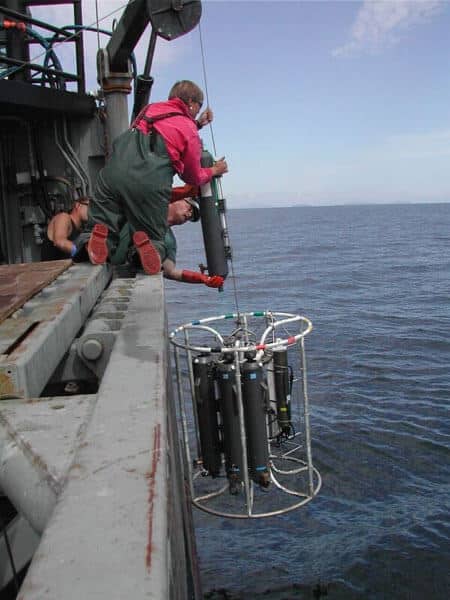
In 2008, CIRCAC coordinated field sampling and analyses among three separate studies, to develop an Integrated Cook Inlet Environmental Monitoring and Assessment Program (ICIEMAP). Through funding secured by our congressional delegation, we developed a Cook Inlet-specific EMAP project using many of the same methods we applied in the earlier western Gulf of Alaska EMAP. Our plans were to stratify the entire Inlet to force random sampling within three “nested” sampling areas: inside produced water mixing zones, within a defined “industry area” and locations representing Cook Inlet background. We also sampled at the mouths of major rivers entering the Inlet. The resultant contaminant analyses of bottom sediments, water column suspended sediments, and sediments entering the Inlet from major rivers provide the most thorough investigation of Cook Inlet contaminants to date.
We worked with personnel who were planning two separate studies that overlapped our planned Cook Inlet EMAP sampling in data needs and sampling area. We recommended all three projects share logistics and sampling costs, agreed on field sampling methods and on independent laboratory analyses. The partners concurred we might disagree on the data interpretation, but we could agree that the sampling methods, quality control, and laboratory analyses were solid. The two additional studies were a NOAA National Status & Trends Bioeffects Study for Kachemak Bay and a Produced Water Discharge Study required by industry under their Cook Inlet General Oil and Gas National Pollutant Discharge Elimination System Permit. In 2009, a component of ICIEMAP included sampling the water column by following a “drogued” drifter buoy to track the discharge plume from Cook Inlet’s largest produced water discharge source.
PARTNERSHIP SAMPLING
CIRCAC has recently partnered with various state and federal agencies to move projects forward that will help identify other potential sentinel species populations and archive sediment and tissue samples for future analyses. In 2009 we worked with the National Park Service (NPS) to look at bivalves along Lake Clark National Park coastlines between Drift River area and Chinitna Bay. In 2009, 2011, 2012, and 2014 we participated with NPS’s Southwest Area Network program sampling along the Katmai national park coastline, which is downstream of the Cook Inlet oil industry operations. In 2015 we also worked with NPS on a project funded by the Bureau of Ocean Energy Management to assess seaweeds and invertebrates in lower Cook Inlet and will include a component for hydrocarbon sampling in the future.