Mitigating Risks through Prevention and Response
Once the genie is out of the bottle, it’s hard to put him back in. CIRCAC has consistently focused on prevention as a key strategy to preventing oil from reaching Cook Inlet’s waters and shorelines. Among our highest priorities during our first 25 years was to conduct a thorough navigation risk assessment of Cook Inlet, to effectively identify risks posed by navigation and the specific measures we could take to reduce or eliminate those risks. During the years’ long risk assessment process, we worked to implement immediate changes to improve navigation safety, such as advocating for a permanent docking assist and rescue tug in Kenai. What follows are more details about CIRCAC’s major program initiatives for prevention and expediting response to lessen the impacts of catastrophic spills.
COOK INLET NAVIGATIONAL RISK ASSESSMENT
Within our first year as an organization, CIRCAC completed a full review of vessel navigation, pilotage, terminal operations, oil spill contingency plans and risk assessment issues in Cook Inlet and continued that focus for the next 23 years. Our projects included an assessment of vessel traffic, facility operations; oceanographic, environmental and pipeline conditions; and response equipment, personnel and training for oil spill response. We assisted in state and federal efforts to conduct and administer navigational and infrastructure risk assessments that address Cook Inlet’s unique conditions.
We also convened the first Safety of Navigation Forum and participated in a three-year study of the Safety and Efficiency of Navigation in Cook Inlet, followed by a second Safety of Navigation in Cook Inlet forum, resulting in the recommendation to conduct a comprehensive risk assessment before additional prevention measures be put into place. With that as our focus, we commissioned a Vessel Traffic study to serve as a reference document to support discussions regarding associated environmental risks and mishap prevention initiatives. The study included an update of vessel traffic movements over a twelve month period.
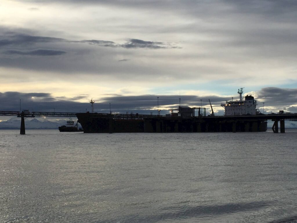
The grounding of the Seabulk Pride gave the risk assessment new urgency. The second Navigational Safety Forum reached the consensus: conduct a navigational risk assessment. Following years of meetings, studies, and public forums led by a Management Team and Advisory Panel of Experts, the Cook Inlet Navigational Risk Assessment was completed in 2015. This assessment and the studies leading up to its final recommendations motivated significant changes for improving navigation safety, including construction of a docking assist/rescue tug specifically for Cook Inlet, updating existing navigation safety measures, amending the Cook Inlet winter ice rules, creating the ice forecasting camera network, and convening the first Cook Inlet Harbor Safety Committee, discussed later in this report.
DOCKING ASSIST TUG
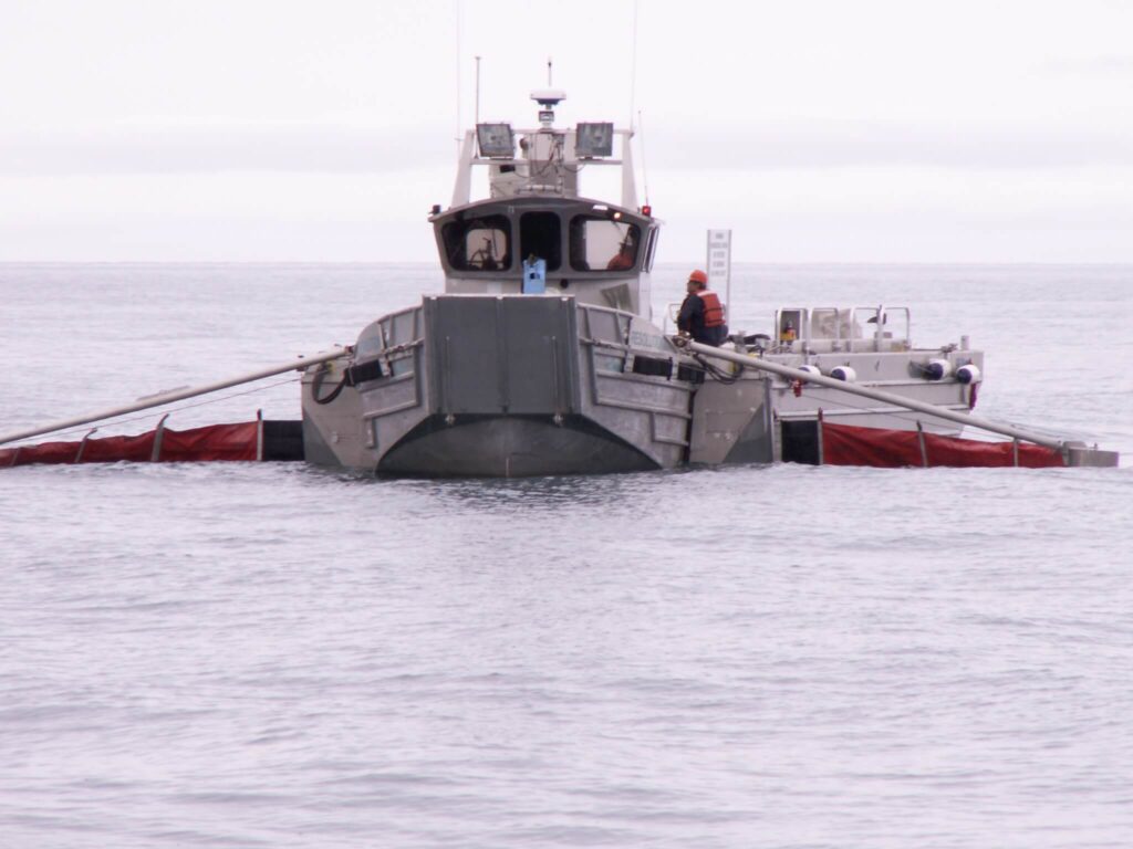
In 2006, the Seabulk Pride broke free from its moorings at the Kenai Pipe Line (KPL) dock and ran aground. CIRCAC immediately commenced to work with industry and regulators to secure a permanent docking assist and rescue tug in Nikiski as a key oil spill prevention and response component. We successfully advocated the tug be required in contingency plans. Tesoro Alaska contracted with Crowley Marine in 2007 to bring the Tug Protector to Cook Inlet to assist tankers to moor at the KPL dock. In 2013, the Tug Bob Franco was specifically designed and built for the Inlet’s demanding conditions, with increased capability for response operations, with a tow winch suitable for ocean towing, firefighting and rescue, and heated decks, among many other features.
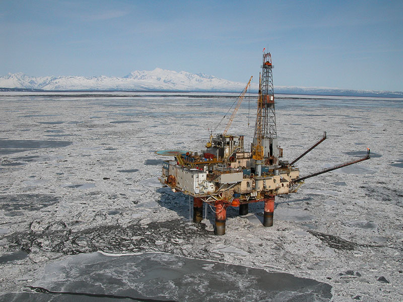
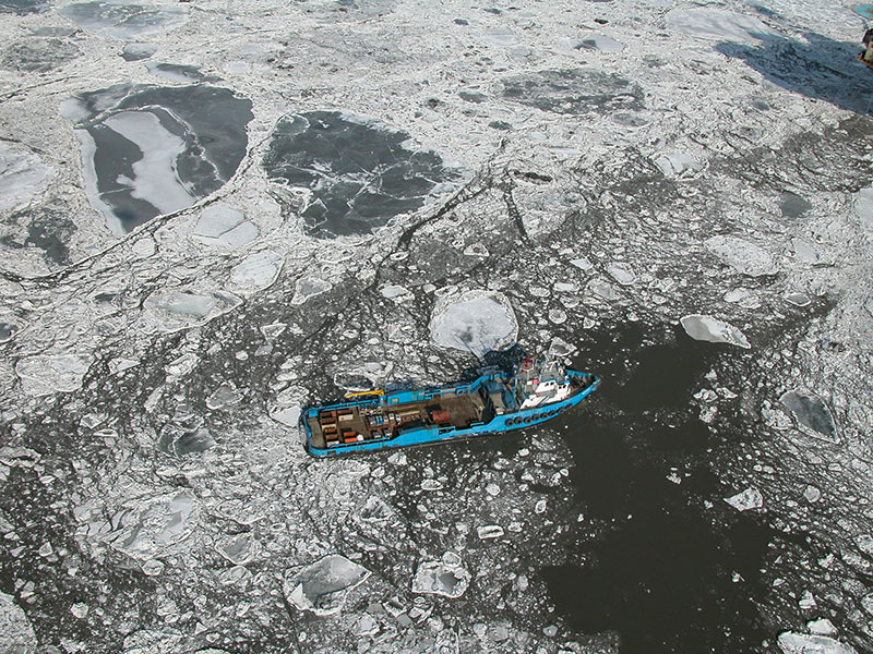
CONFRONTING THE CHALLENGES POSED BY WINTER ICE
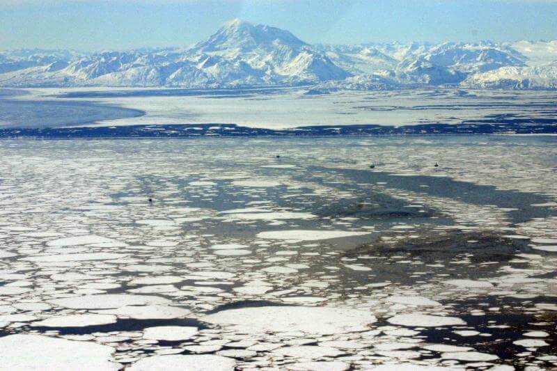
In 1996, CIRCAC and Cook Inlet Spill Prevention and Response, Inc. (CISPRI) conducted a broken ice study to track, by air and land, ice buildup and movement in Cook Inlet to ascertain the most appropriate cleanup strategies. CIRCAC also co-sponsored an ice symposium which convened mariners and scientists to identify navigational problems and technological solutions for Cook Inlet’s winter ice conditions.
An earlier safety of navigation forum identified ice as a major risk for potential oil spills and a threat to vessel traffic. Based on work CIRCAC completed with CISPRI, in 1996-97 state agencies incorporated winter ice conditions in contingency plans to help identify operating limitations. In 1998, we advocated for amendments to winter rules to include specific operating conditions and restrictions during severe ice conditions.
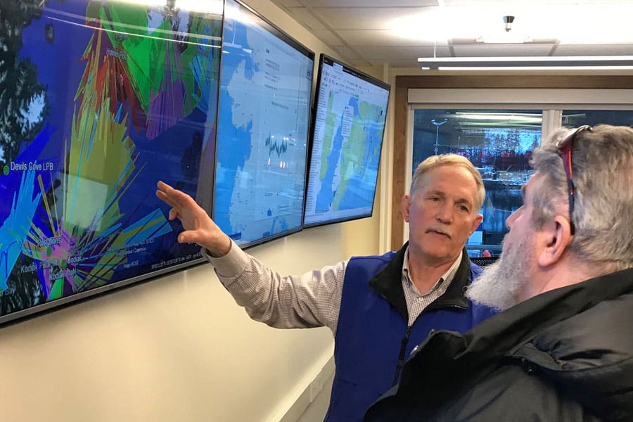
ICE CAMERA NETWORK
In February of 2006, after the Seabulk Pride grounding, CIRCAC staff approached the NOAA Ice Forecaster about coordinating an Ice Forecasting Network to consist of about a dozen reporting stations, including offshore and shore side facility operators, beginning at the Port of Anchorage and extending south. Each facility operator was asked to provide the Ice Forecaster with observation reports and digital photographs twice daily; these proved to be a great asset. In August of 2008, CIRCAC committed funds to purchase the first cameras. The ice forecasting network of cameras now in place complements Cook Inlet satellite radar images, overflights, and field observations available to NOAA’s ice forecasters.
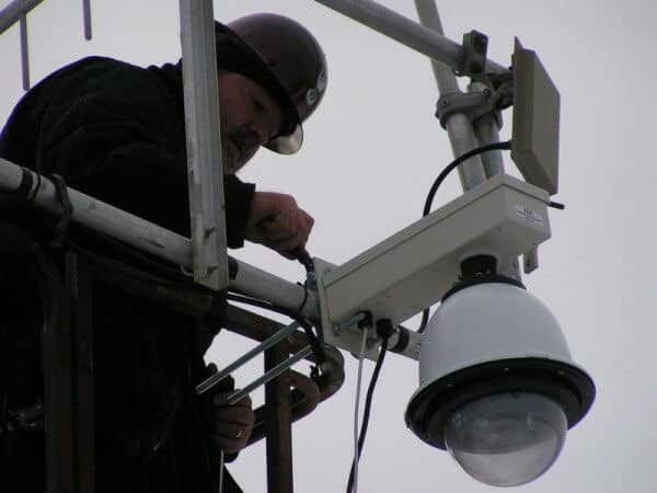
CIRCAC secured funding, selected suitable cameras, identified strategic locations for camera placement, negotiated location access and use, developed a priority hierarchy and operation plan, installed the high resolution pan, tilt, zoom, cameras; and initialized the system. CIRCAC then turned the system control over to the NOAA Ice Forecaster based in Anchorage, who now uses it to produce ice analysis charts and a text forecast that are distributed via the National Weather Service network, posted online, and transmitted via the old marine fax system.
In 2015, the network consists of nine cameras at strategic locations for optimal viewing in the Middle and Upper Cook Inlet and continues to serve as an essential oil spill prevention component, providing better ice forecasts and knowledge of real-time ice conditions. The National Weather Service relies on the network to aid in preparation of aviation weather forecasts. CIRCAC is working to provide public access to the images.
CONTINGENCY PLAN & PERMIT REVIEWS
Quick response can deflect or minimize impacts to resources. Required by state and federal law, contingency plans describe the procedures, personnel, equipment, and resources to be mobilized in the event of an oil spill. CIRCAC has been proactive in ensuring that oil discharge prevention and contingency plans for the Cook Inlet area meet, and in some cases, exceed regulatory compliance.
Contingency plan review is fundamental to CIRCAC’s responsibilities as a citizen representative. CIRCAC first evaluated Cook Inlet operators in 1992 and developed and adopted protocols to guide our review process for vessels and both onshore and offshore facilities. Through CIRCAC’s Contingency Plan Review program–overseen by our Protocol Control Committee–we work to ensure that measures and considerations are in place to prevent spills, speed response and decrease chances of long-term impacts.
Through review of permits, policies, and site-specific regulations relating to oil terminal facilities, crude oil tanker operations and maintenance, CIRCAC supplies respected input affecting legislation, federal rules, policy decisions and reports that play a role in prevention and response measures.
To date, CIRCAC has conducted hundreds of reviews and developed comments and recommendations for oil discharge prevention and contingency plans, various proposed and existing regulations, technical manuals, and proposed rule changes including the Alaska Unified Plan and the Cook Inlet and Kodiak Sub-area Plans.
We extensively reviewed the Alaska Pollutant Discharge Elimination Permit and National Pollutant Discharge Elimination Permit for Cook Inlet oil and gas exploration, and stressed that the proposed permit limits and mixing zones should be reevaluated and recalculated to ensure that the total concentrations and pollutant loadings are not increase, but that every effort be made to move toward zero discharge.
VOLUNTARY PIPELINE ACTIVITY REPORTS
As part of an ongoing arrangement with CIRCAC, Cook Inlet operators submit voluntary pipeline activity reports to the Prevention, Response Operations and Safety Committee (PROPS). Operators explain the activities, inspections, tests, and upgrades under way for their Cook Inlet assets, including sonar surveys, subsea inspections and pigging of pipelines and follow-up on discrepancies. In this way, CIRCAC is kept informed and can monitor the most current status of Cook Inlet’s pipeline infrastructure.

INNOVATING FOR FASTER RESPONSE
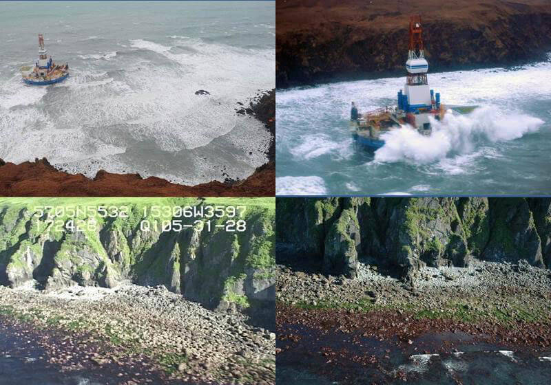
Another innovative CIRCAC project was designed to get information quickly into the hands of emergency response decision makers following an oil spill and to assist managers in spill prevention. In 2012, CIRCAC partnered with the Alaska Ocean Observing System (AOOS) to develop a tool that could merge high resolution shoreline video with natural resource data, ocean and atmospheric real-time sensor data and ocean current and wind model. The Cook Inlet Response Tool, CIRT, provides a platform to make an incredible amount of data available to responders, planners, researchers and the general public. With CIRT, responders are able to “see” an area without being on scene. They can access shoreline habitat data, video and photographs of area beaches, and gain valuable information to prepare them for what to expect, thus improving the response. This tool’s capabilities were first proven – weeks before its official launch date – during the grounding of the drilling rig Kulluk on Sitkalidak Island near Kodiak, after the tow line parted in heavy weather on December 31, 2012. CIRT provided crucial information 12 hours before the first overflights were able to get on-scene to photograph the grounded rig.
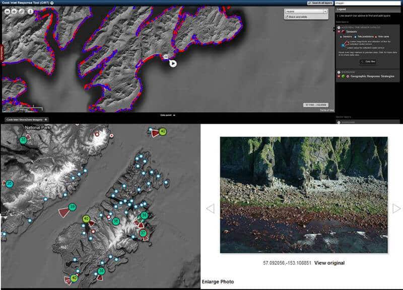
Because updates will continually be made as new data become available, the CIRT project is ongoing. CIRCAC and AOOS are providing the necessary training to industry, regulators, oil spill response organizations and others who are interested in utilizing the tool.
GEOGRAPHIC RESPONSE STRATEGIES
Some CIRCAC projects were designed and implemented to reduce the risks of impacts following a spill by saving time during the first critical 24-48 hours of an oil spill response.
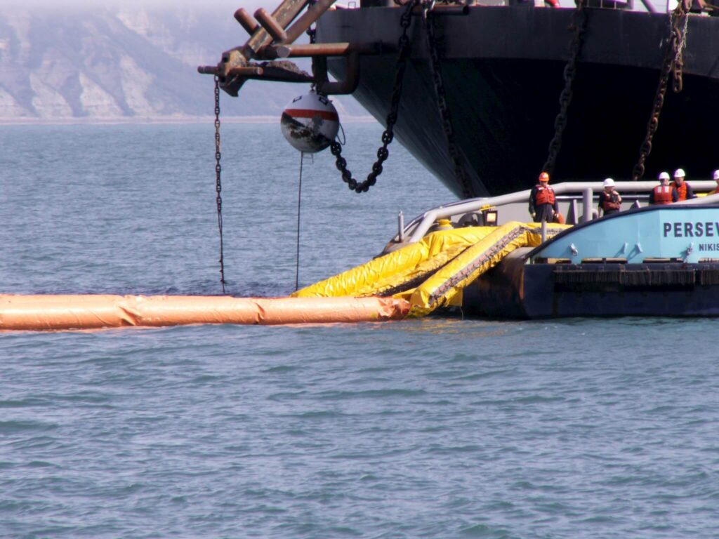
Geographic Response Strategies (GRS) are one of CIRCAC’s most important and enduring initiatives for expediting response time and lessening impacts. These map-based strategies help prioritize sensitive areas and show responders locations to place oil spill protection resources, such as protective boom. CIRCAC led the development of GRSs for Cook Inlet, providing funding, participating in work groups, gathering public comment on proposed sites, and participating in the collaborative years’ long effort to identify and develop response strategies for Cook Inlet’s most sensitive areas.
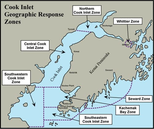
By 2015, response strategies have been developed for approximately 160 sites. These are incorporated into sub-area contingency plans for Northern, Central, Southwestern and Southeastern Cook Inlet, Kachemak Bay, Seward, and Kodiak’s Northern, Western, Mainland, Eastern and Southern Zones. Through another CIRCAC initiative, GRSs have been integrated with ShoreZone imagery in the Cook Inlet Response Tool (see below) and other data layers, to provide oil spill responders with quick access to critical information.
POTENTIAL PLACES OF REFUGE
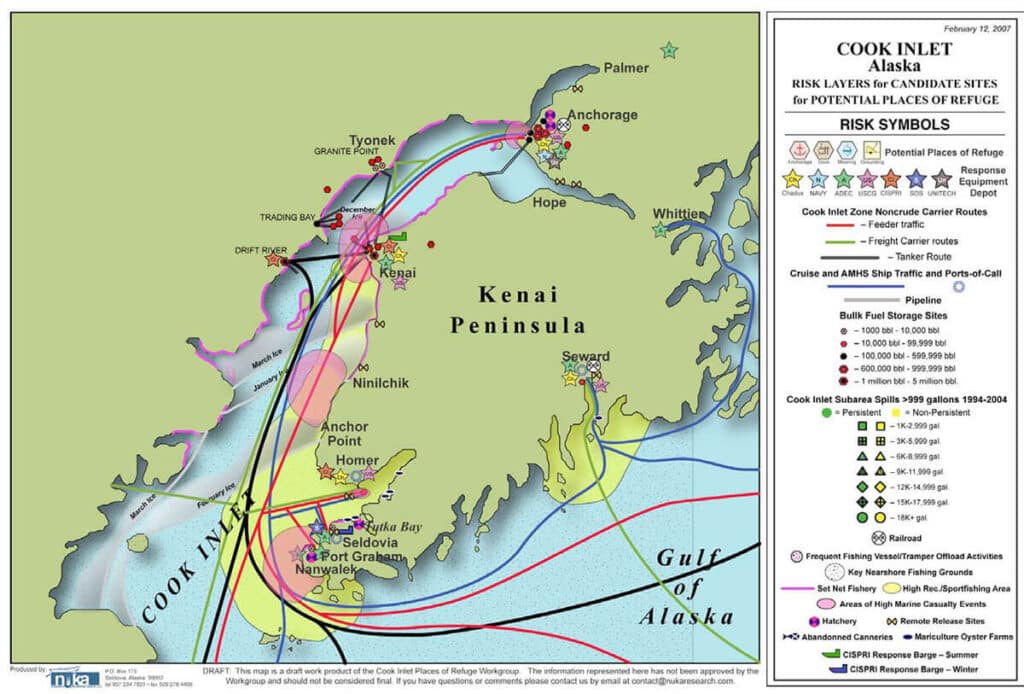
CIRCAC participated in the Potential Places of Refuge work groups to identify and prioritize 56 potential safe moorage sites throughout the Cook Inlet Region and 95 sites around Kodiak.
A “place of refuge” is defined as a location which can temporarily accept a vessel needing assistance to stabilize the vessel, protect human life, reduce a hazard to navigation, and/or protect sensitive natural resources and other uses of the area (e.g., subsistence collection of mussels, commercial fishing, recreational boating). A place of refuge may include constructed harbors, ports, natural embayments, potential grounding sites, or offshore waters.
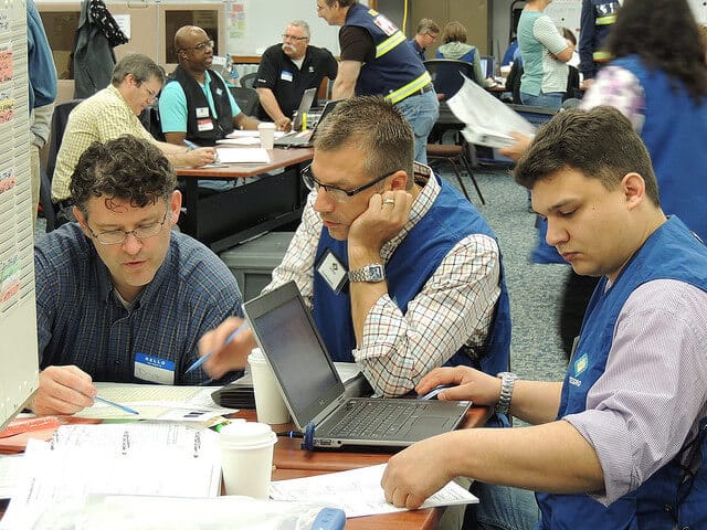
PRACTICING FOR QUICKER, BETTER RESPONSE THROUGH DRILLS & EXERCISES
Oil spill drills familiarize responders with equipment and procedures to clean up a spill, which leads to quicker and more efficient responses during actual incidents. Drills also promote good working relationships between all participants, including State, Federal and responsible party representatives within the Incident Command System (ICS).
Since 1990, CIRCAC has participated in more than one hundred table-top drills with Cook Inlet operators (Unocal, Tesoro, ConocoPhillips, Chevron, XTO Energy, Forest, Perl, Cook Inlet Energy, Hilcorp Alaska, Shell, ARCO Alaska, Marathon, Buccaneer Energy, Escopeta, Aurora, Furie, Cook Inlet Pipe Line, and Apache), on-water deployments, worst-case scenarios, tanker arrest and towing, and special equipment testing demonstrations.
CIRCAC participates at most levels of the ICS, bringing scientific, regional and technical expertise to the command center and promoting citizens’ interests and concerns within the Joint Information Center (JIC). Developed to improve and coordinate communication during a response, Alaska’s implementation of the ICS has come a long way towards improving oil spill response and lessening the harmful effects of a spill by working together to fix the problem.
MARINE FIREFIGHTING MANUAL
CIRCAC participated in developing a marine firefighting manual (contingency plan) for the Cook Inlet and Kodiak areas. The plan is based on the assumption that a major marine fire, particularly a vessel fire, may require resources beyond those locally available and that effective response will require coordination of resource deployment from a number of organizations. This planning is essential for Cook Inlet because of several categories of issues such as: the physical difficulties encountered (distances between areas of risk, tides, currents, and ice); administrative difficulties (jurisdictional overlap, mutual aid protocols not fully established or practiced); and logistical difficulties (except for Port of Anchorage, Nikiski and Homer, landside access to vessels and platforms and lack of accessible resources including qualified marine firefighters).
This manual supports a coordinated response by the U.S. Coast Guard and other federal, state, local, and civilian forces to fires on board vessels or at waterfront facilities.
GEOGRAPHIC RESPONSE INFORMATION NETWORK
During every oil spill response personnel, materials, and equipment in large and small quantities need to be procured, transported, and delivered to various locations. Carrying out these tasks is no small feat. The information needed to accomplish this task resides in many different places in as many different formats. To aid in this endeavor CIRCAC developed the Geographic Response Information Network (GRIN), an easy to use web-based database, in a format that simplifies logistics, safety, and public outreach relevant to oil spill response in the Cook Inlet region. The GRIN database can be queried and displayed by region or individual communities; enabling Incident Command Operations, Planning, and Logistics sections to identify assets easily and early in response efforts, helping to ensure a successful response.
BEST AVAILABLE TECHNOLOGY
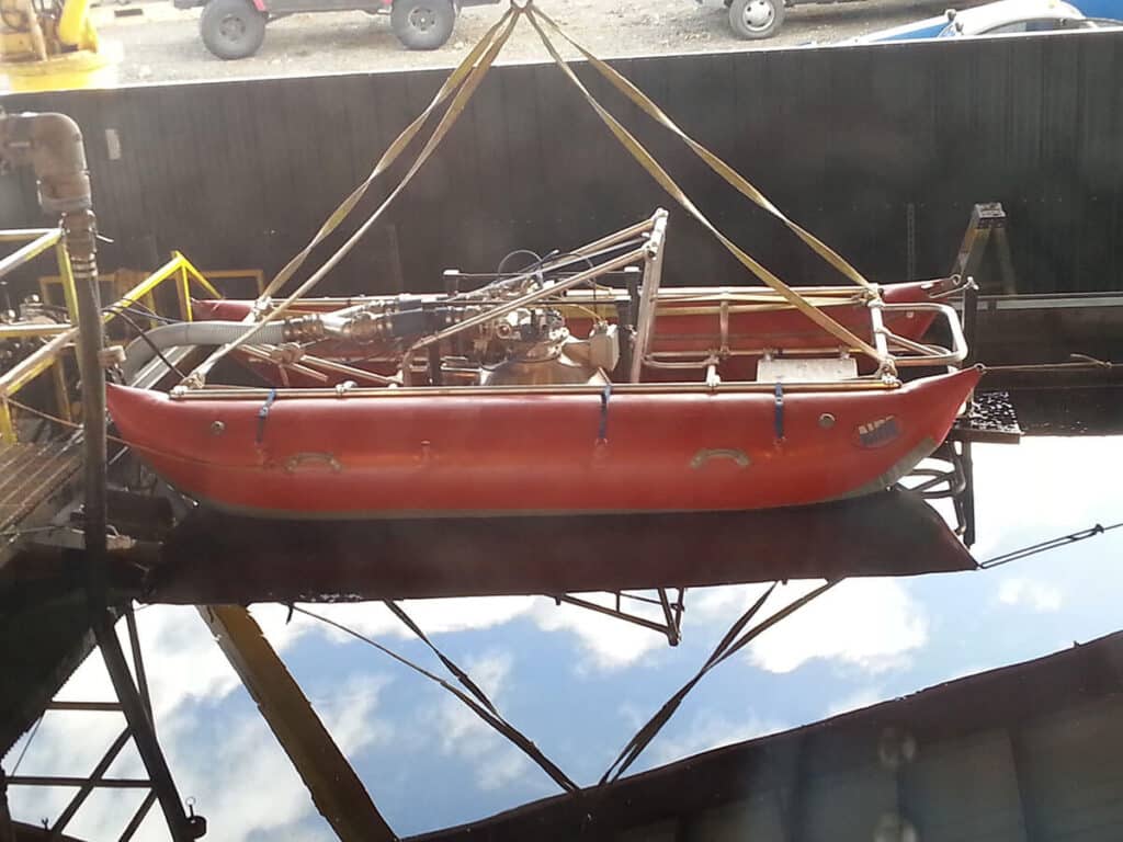
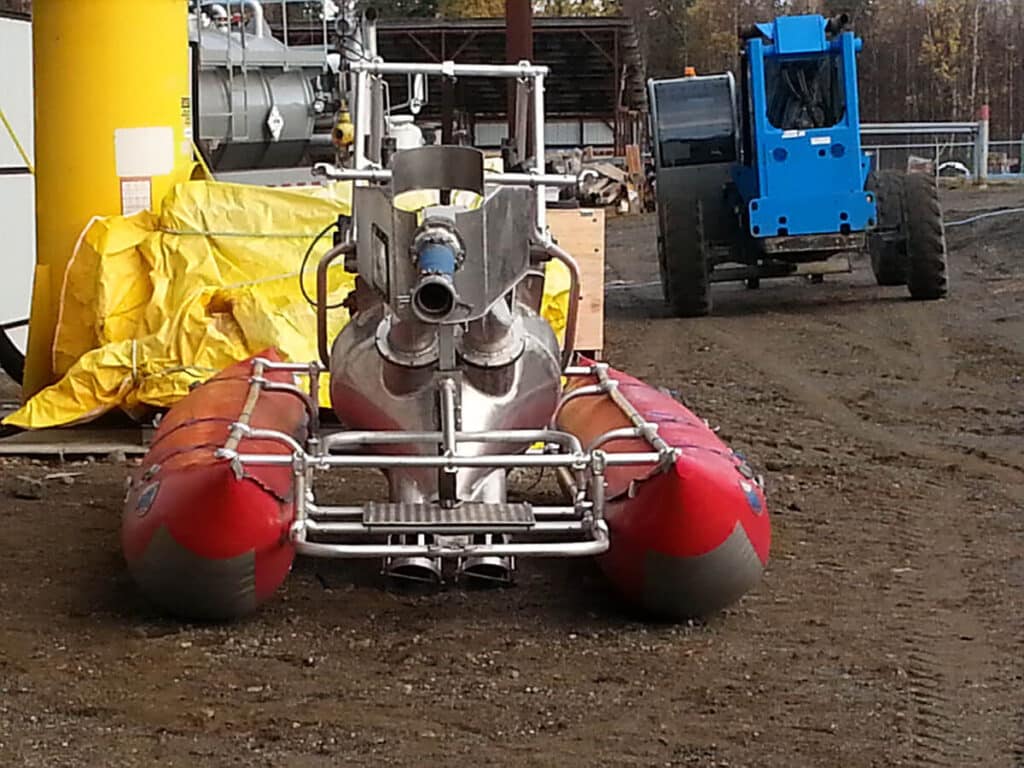
Complacency on any level is unacceptable, and CIRCAC has long been involved in promoting best available oil spill prevention and response technology to improve our success rates in cleaning up oil. For decades, manufacturers pushed the same technology forward, with low expectations becoming the norm. But research and development of new skimming technology in 2007 appeared promising for Alaska’s oil spill prevention and response community. Following years of testing, design modifications, and regulatory review, in 2013 the State of Alaska approved a new skimming system to operate in Cook Inlet and Prince William Sound.
This skimming system out-performed traditional technology in use in Alaska since the Exxon Valdez. CIRCAC supported and encouraged industry’s efforts to incorporate the skimmer into CISPRI’s arsenal of oil spill response equipment and continues to encourage and support other new recovery technologies.
IN SITU BURNING
In 1993, CIRCAC took the formal position that in situ burning should be a preferred response option in mobile, winter ice conditions in upper and central Cook Inlet. We maintain that position today, though we recognize that mechanical containment recovery is always the preferred option, there are limitations in ice. CIRCAC participates in Alaska Regional Response Team workgroups and continues to provide comments on in situ burning guidelines for Alaska and the nation.