This program was developed in part to address a Cook Inlet RCAC Oil Pollution Act of 1990 (OPA 90) mandate to “study wind and water currents and other environmental factors in the vicinity of the terminal facilities which may affect the ability to prevent, respond to, contain, and clean up an oil spill.”

The program purpose is to understand and model Cook Inlet’s complex circulation patterns, leading to an ocean observing system and models that nest within a larger regional and state-wide Alaska Ocean Observing System to provide real-time data and forecasts.
Anyone who spends any time on a boat in Cook Inlet understands the power of its currents. The strongest and most noticeable currents are the tidal currents, driven by the tidal fluctuations that are commonly over 25 feet, and even greater in the very upper Inlet. The current directions reverse depending on whether the tides are ebbing out of or flooding into the Inlet. These currents are so strong that Cook Inlet was called “Cook’s River” for a time when being explored in 1778 by Captain James Cook (The Life of Captain James Cook, 1974, By: J.C. Beaglehole) and the Dena’ina name for Cook Inlet is Tikahtnu meaning “Big Water River”.
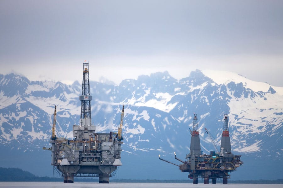
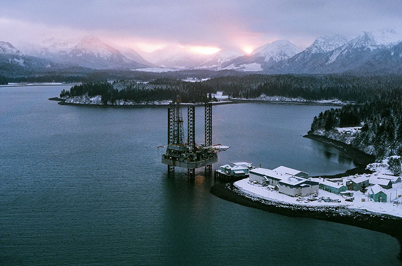
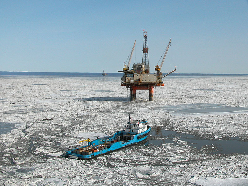
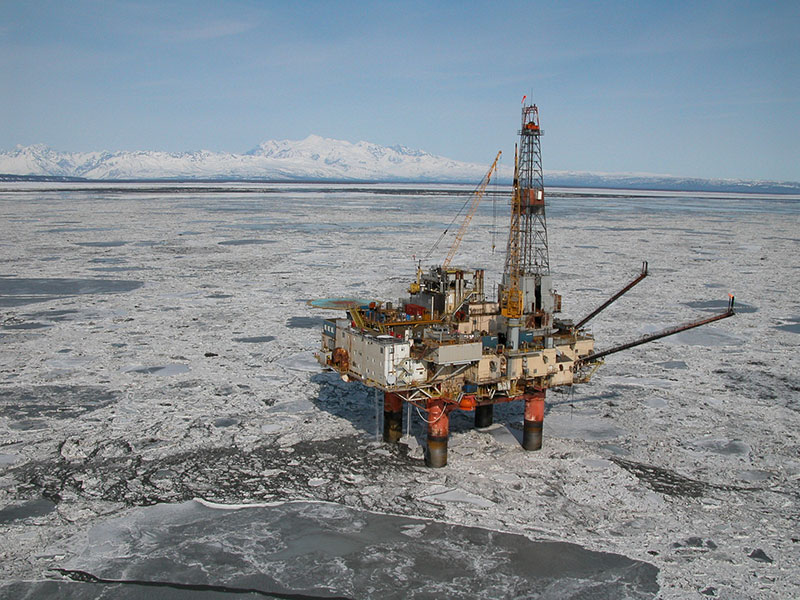
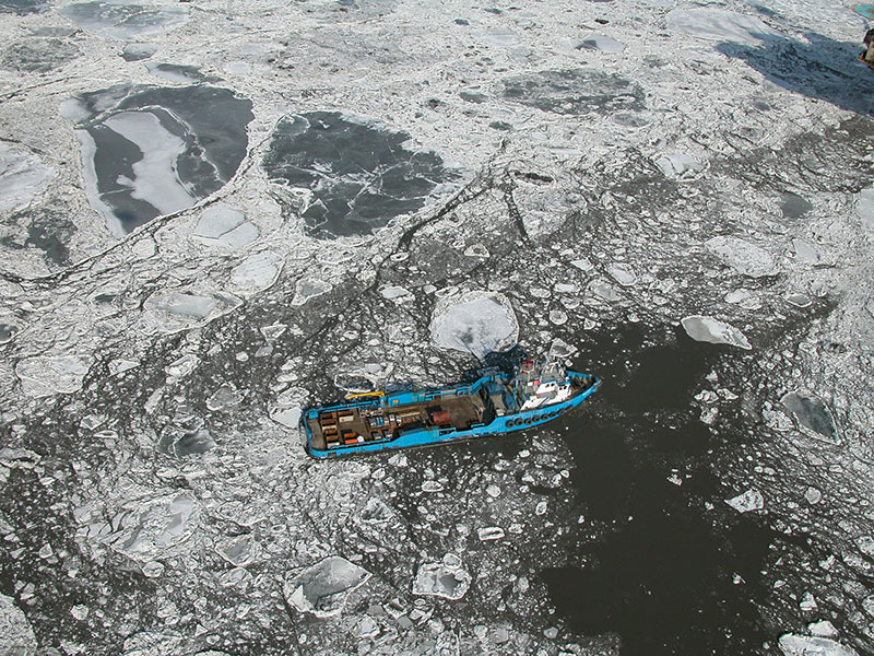
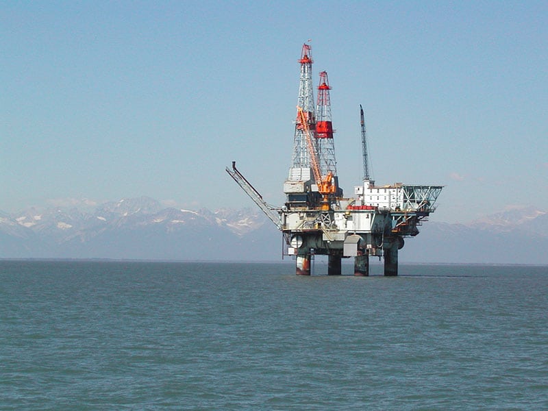
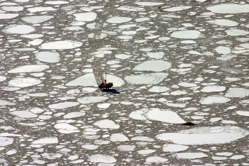
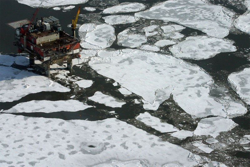
The images of ice moving past Cook Inlet platforms [Seen below] are great examples of how strong the tidal currents are in the Inlet, where the pans of ice are pushed by the currents.
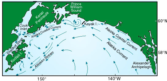
A keen observer will note that in many areas of the Inlet, the ebb current is stronger than the flood current. Huge volumes of freshwater are introduced by glacial and non-glacial streams and rivers (e.g. Susitna, Matanuska, Knik, Beluga, Kenai, and Kasilof rivers) in the upper Inlet and the head of Kachemak and other bays (e.g. Fox and Bradley Rivers). The freshwater increases the volume of water leaving the Inlet and results in density-driven currents on top of the tidal currents and a “net” outflow from Cook Inlet. Another density-drive current that influences Cook Inlet is the Alaska Coastal Current (ACC) [Seen in Figure 2 below], a counter-clockwise nearshore current around the Gulf of Alaska that is driven by freshwater runoff. The ACC enters the lower Inlet on the east side, and exits on the west near Cape Douglas and the influence of this current on Cook Inlet circulation is seasonally dependent. All of these currents, and others, interact with each other and also interact with Cook Inlet’s bathymetry, resulting in complex and changing circulation patterns.
Click to view larger
Click to view larger
Click to view larger
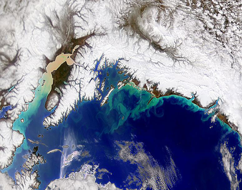
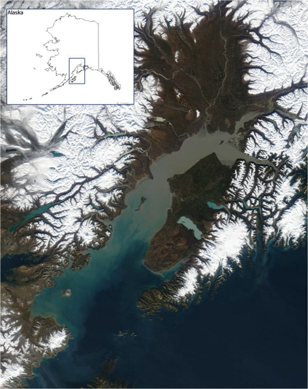
Our interest in Cook Inlet’s currents is not only to understand how oil or contaminants would be transported from their source. Water circulation patterns are especially important for understanding intertidal and nearshore systems as the prevailing currents determine the transport of food and larvae to and from these habitats. As well, Cook Inlet’s unique physical oceanography influences the distribution of intertidal, nearshore, and benthic habitats throughout the Inlet, by creating either sediment depositional or erosional/scouring environments. Satellite images show the incredible volumes of sediment that are introduced into Cook Inlet by glacial rivers [Seen in Figure 3 & 4 above]. Some of the sediment is deposited within the Inlet and high currents in other areas keep the sediments suspended and swept out of the Inlet to deposit in other areas of the Gulf of Alaska (e.g. Shelikof Strait).
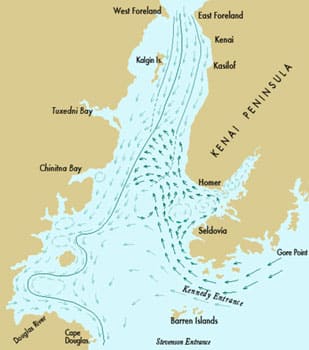
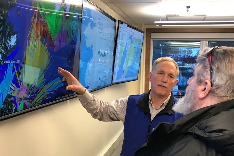
A limited number of historical studies have provided some understanding of Cook Inlet’s complex circulation. However, most of these historical studies were limited by season or location and the published circulation maps over-simplified some currents and over-represented others [Seen in the image on the right]. More recent studies will allow us to tease out details of the Inlet and better understand how currents vary in space and time so that we can ultimately better predict their movement.
Physical oceanography observations and data help us better describe and understand circulation patterns and what drives the currents in Cook Inlet. For example, how important is the Alaska Coastal Current’s influx into the Inlet in driving net circulation in the lower inlet? How do seasonal changes in freshwater input into upper Cook Inlet change the net outflow along the west side of Cook Inlet? How much do the Cook Inlet convergent zones (tidal rips) influence collection, mixing, and transport of spilled oil and/or debris? These questions are important to answer so we can better predict and describe how water currents might transport surface oil spills or contaminants from discharge plumes towards sensitive habitats organisms.
Ensure that high resolution observational oceanic and atmospheric data, including sea ice and bathymetry, are available to develop accurate models and tools that can be integrated into oil spill prevention and response planning.
Promote collaborations and partnerships between and among researchers and organizations to support other goals.
Provide leadership in developing a comprehensive Cook Inlet physical oceanography observing system.
Make all data accessible to resource agencies, industry, the public, and other organizations.
5002 (f) (2)
(C) study wind and water currents and other environmental factors in the vicinity of the terminal facilities which may affect the ability to prevent, respond to, contain, and clean up an oil spill.