Cook Inlet Satellite Drifter Buoys
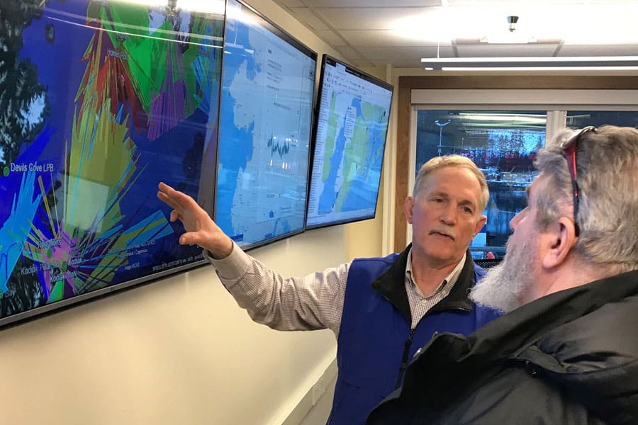
One way to observe net currents is to deploy drifter buoys that are carried by the currents. By periodically sending its position via satellite, its track line allows us to see how it is transported by the currents. Drifts can be either “surface” drifters or they can be “drogued” at various depths such that the underwater sail (drogue) catches subsurface currents. Cook Inlet RCAC purchased satellite-tracked drifter buoys as part of a larger project by the University of Alaska Fairbanks, Institute of Marine Science to investigate the dynamics of the water and ice in Cook Inlet using a combination of high resolution numerical modeling and observations. An example of a drifter deployed during the study is shown here {Either link to picture or embed here}. The final report by the Principal Investigator, Dr. Mark Johnson, can be found at:
Johnson, M. A .2008. Water and Ice Dynamics in Cook Inlet. Final Report. OCS Study MMS 2008-061. University of Alaska Fairbanks Coastal Marine Institute and USDOI, MMS, Alaska OCS Region, 106 pp.
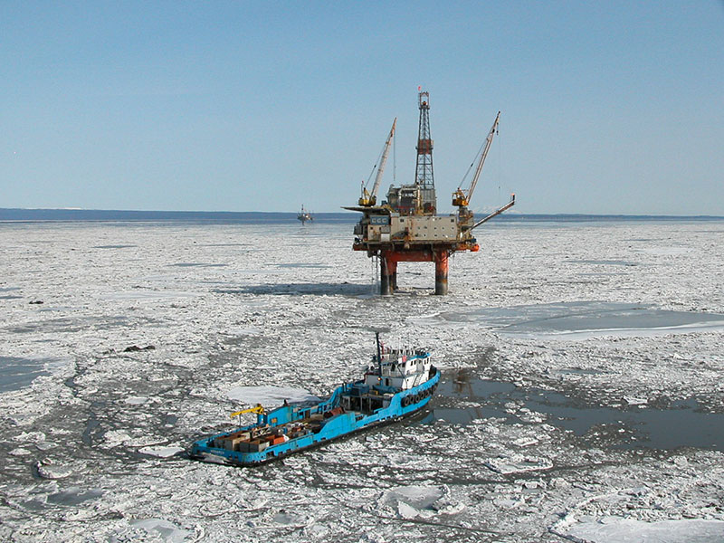
In order to improve our understanding of the physical environment of lower Cook Inlet and to augment other recent observational and modeling efforts, Cook Inlet RCAC obtained funding from the Coastal Marine Institute to (1) measure the seasonal changes in volume and property fluxes at the inflow and outflow boundaries to Cook Inlet and the northern Gulf of Alaska and (2) to investigate the mechanisms(s) influencing these fluxes. The study acquired hydrographic and velocity measurements along transect lines crossing Kennedy Entrance, Stevenson Entrance, northern Shelikof Strait between Shuyak Island and Cape Douglas, the entrance to Kachemak Bay, from Anchor Point west, from Port Graham to Augustine Island, and between the east and west Forelands [See map to the right/below]. The data were also provided to Dr. Mark Johnson for his Water and Ice Dynamics study described above.
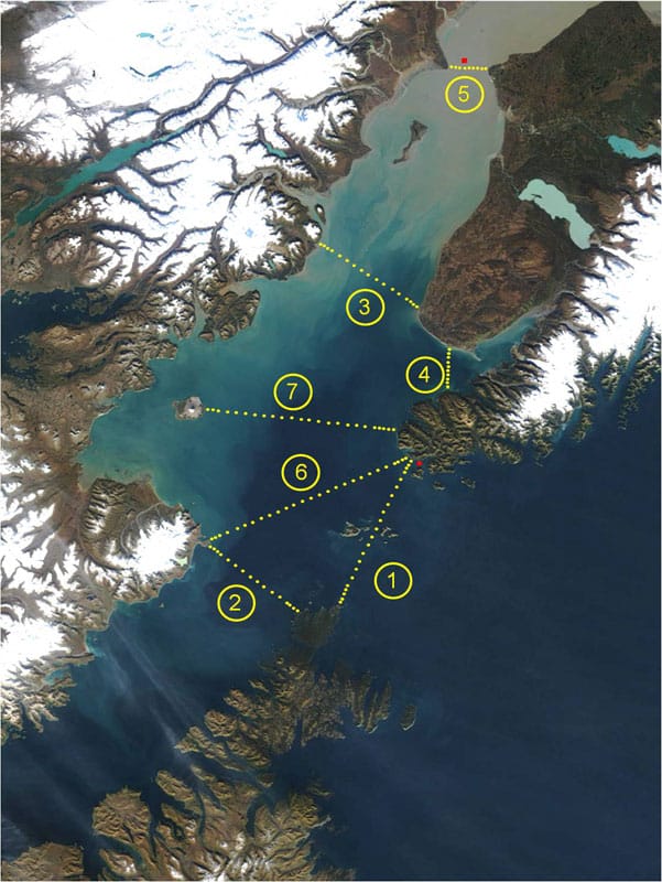
Click to view larger
A final report for the Hydrographic Survey study can be found at:
Okkonen, S.R., S. Pegau, and S.M. Saupe. 2009. Seasonality of Boundary Conditions for Cook Inlet, Alaska. Final Report. OCS Study MMS 2009-041, University of Alaska Coastal Marine Institute and USDOI, MMS, OCS Region, 59 pp.
Prior to the “Seasonality of Boundary Conditions” study, a pair of studies provided insights into the currents and oceanographic conditions in Cook Inlet for more focused locations and time-frames.
Okkonen, S.R. 2005. Observations of hydrography and currents in central Cook Inlet, Alaska during diurnal and semidiurnal tidal cycles. Final Report. OCS Study MMS 2004-058, University of Alaska Coastal Marine Institute, University of Alaska Fairbanks and USDOI, MMS, Alaska OCS Region, 27 p.
Okkonen, S.R. and S.S. Howell. 2003. Measurements of temperature, salinity, and circulation in Cook Inlet, Alaska. Final Report. OCS Study MMS 2003-036, University of Alaska Coastal Marine Institute, University of Alaska Fairbanks and USDOI, MMS, Alaska OCS Region, 28 p.
Cook Inlet Physical Oceanography Workshops
Cook Inlet RCAC has promoted coordination of physical oceanographic research in Cook Inlet with an eye towards improving our understanding of Cook Inlet’s complex circulation through integrated data collections and providing observational data to atmospheric and ocean model developers. In 1999, we hosted a workshop in Kenai to bring together physical oceanographers and modelers to describe their knowledge and efforts in Cook Inlet. The 1999 workshop was hosted by Cook Inlet RCAC in Kenai, Alaska with funding for workshop costs provided by the Oil Spill Recovery Institute and funding for workshop proceedings provided by Minerals Management Service.
More recently, Cook Inlet RCAC has worked closely with the Alaska Ocean Observing System (AOOS) to develop a Cook Inlet Ocean Observing System plan. A major step in the process was working with AOOS and the Kachemak Bay Research Reserve to pull together a group of experts in Cook Inlet physical oceanography and modeling during a workshop in February 2005. The major goals for the workshop were to provide descriptions of on-going research and monitoring in Cook Inlet waters and to assess the needs for products and services to aid mariners, scientists, industry, resource managers, educators, and other users of marine resources. The workshop results were used to frame issues important to an ocean observing system in Cook Inlet. Proceedings were compiled by Dr. James Schumacher (“Two Crow”).
CIRCAC provided logistical support to the University of Alaska Fairbanks, School of Fisheries and Ocean Sciences, Institute of Marine Science for their Sea-Air-Land Monitoring and Observing Network (SALMON) project. This project used Coastal Ocean Dynamic Applications Radar (CODAR), type of high-frequency surface current mapping radars, to test the instruments for measuring surface current speeds and directions in tidal rip areas of Cook Inlet. The Principal Investigator for this project was Dr. Dave L. Musgrave. Cook Inlet RCAC staff provided a location to deploy one of the two instrument arrays throughout the winter deployment and provided logistics for the CODAR team throughout the length of the study. The final report is Muscgrave, D. and H. Statscewich. 2006. CODAR in Alaska. Final Report. OCS Study MMS 2006-032, University of Alaska Coastal Marine Institute, University of Alaska Fairbanks and USDOI, MMS, Alaska OCS Region, 23 p.
Oil Spill Trajectory Model – Version 2.01 Feb 29, 2000
The purpose of the Cook Inlet Oil Spill Trajectory Model is to track the trajectory (path) of surface floating oil (or other substances) after the user has input initial conditions about the spill and wind conditions. Other surface-floating substances can also be tracked with this model. Download the Instruction Manual prior to installation. Click here to download the Model [.exe file].