The Start of the ShoreZone Program in Alaska
In 2001, Cook Inlet RCAC conducted a demonstration project applying a coastal habitat inventory method called ShoreZone that uses aerial surveys to photograph and map the nearshore habitats.
Although various historical and recent shoreline habitat studies had been conducted in the area, they were typically small in scope, were not contiguous, and used differing methods making it difficult to compare across regions. ShoreZone mapping had been developed in British Columbia as a way to conduct rapid mapping of detailed shoreline information over large spatial scales and we looked to it as a mechanism for compiling a catalog of contiguous imagery and data for the entire shoreline in our areas of concern.
We considered our first surveys in 2001, 2002, and 2003 as demonstrations of the value of ShoreZone methods in Alaska and an opportunity to develop new tools for accessing and using the resulting information. ShoreZone mapping methods had been widely used in British Columbia and Washington State, but we took the opportunity to show the value of ShoreZone information to a wider audience by developing a way to serve it on-line and improving access to the imagery and data for emergency oil spill response.
We were successful – our pilot project in Cook Inlet has led to a state-wide initiative that is ongoing. In addition to providing a biophysical habitat database for our initial Cook Inlet surveys, with our contractors at Coastal and Ocean Resources, Inc., we developed a tool that provided online access to our coastal habitat data and gave anybody with web access the ability to see the imagery of our remote shorelines and virtually “fly” along the coast. As we solicited additional funds and partners in those early years, we presented that project as a model on which to develop any future Gulf of Alaska or even state-wide mapping program for a wide range of users, while providing information that was integral to our oil spill prevention, planning, and response goals.
We succeeded in building interest in Shorezone in Alaska and now, over a decade after our first Cook Inlet survey, there are over 30 partnering organizations and agencies who participate in a state-wide ShoreZone imaging and mapping effort.
Alaska ShoreZone Partnership
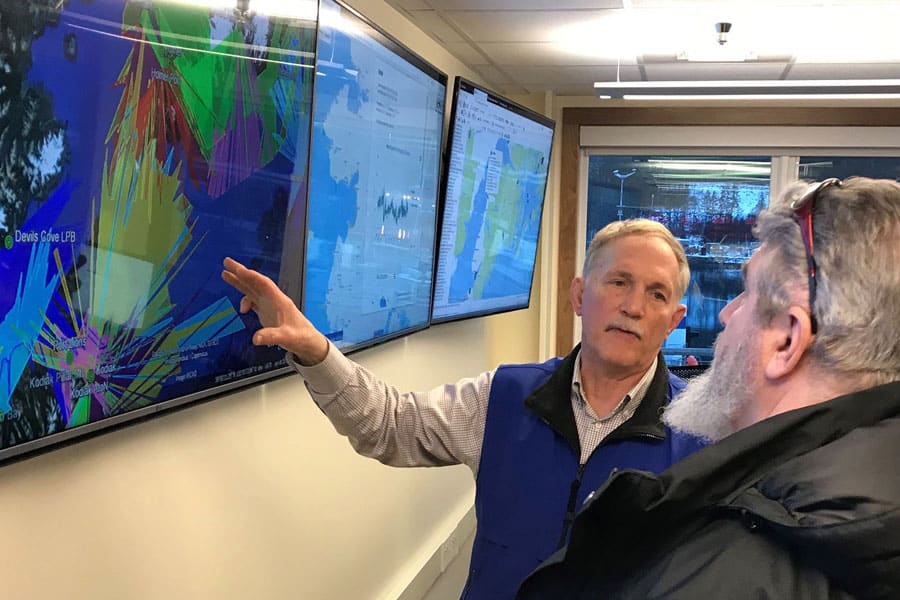
Early on, it became clear that the data and web serving needs of a larger program extended far beyond our study areas and outgrew our ability manage and host the data and website. The National Marine Fisheries Service Alaska Regional Office manages the state-wide Alaska ShoreZone dataset and developed a new and continually upgraded website for viewing, accessing, querying, and downloading the data and imagery.
We can now use the ShoreZone digital imagery of the intertidal zone and nearshore environment to produce an integrated, searchable inventory of geomorphic and biological features to expand our knowledge of our coastal ecosystems. ShoreZone data have become an invaluable tool for oil spill response, community planning, protecting cultural sites, permit review, habitat conservation and invasive species monitoring.
The ShoreZone partnership includes scientists, GIS specialists, web specialists, nonprofit organizations, and governmental agencies. The statewide partnership was described as “unprecedented in size and scope,” when it received a 2009 Spirit Award from Coastal America, for protecting, preserving and restoring the nation’s coastal ecosystems. The Nature Conservancy coordinates this partnership and ShoreZone activities and outreach.